I managed to square away a week off in August when everyone else was still grafting, not long enough time to zip up the cape wrath trail (a bucket lister), but just right for a daunder down the Speyside way.
A very generous offer of lunch in Aviemore ensured the services of a rather attractive driver for the two hour scenic drive from Aberdeen up to Aviemore (along the spey...) on what turned into a cracking Sunday morning.
A grand lunch was taken on the balcony of the Cairngorm mountain sports shop, then a wee wander around the shop trying to persuade myself I didn't need stuff. Finally about 1400hrs after a last minute trolly dash around Tesco for some more supplies it was time to say goodbye and head off to find the start of the walk.
A grand lunch was taken on the balcony of the Cairngorm mountain sports shop, then a wee wander around the shop trying to persuade myself I didn't need stuff. Finally about 1400hrs after a last minute trolly dash around Tesco for some more supplies it was time to say goodbye and head off to find the start of the walk.
My rough idea was to be finished for friday, but earlier or later wouldn't really be a drama, a nice change having a chilled "no pressure" plan. I had about 13/14kg on my back (the Tesco stop had probably added 2kg in sustenance), 7 day old meindl bhutans on my feet and no pre planned bivi spots, a rough daily milage in my head but nothing that couldn't be changed depending on my mood tbh
Sunday - Day 1 (start 1400)
Aviemore to Tarrig Mhore 14 miles

Sunday - Day 1 (start 1400)
Aviemore to Tarrig Mhore 14 miles

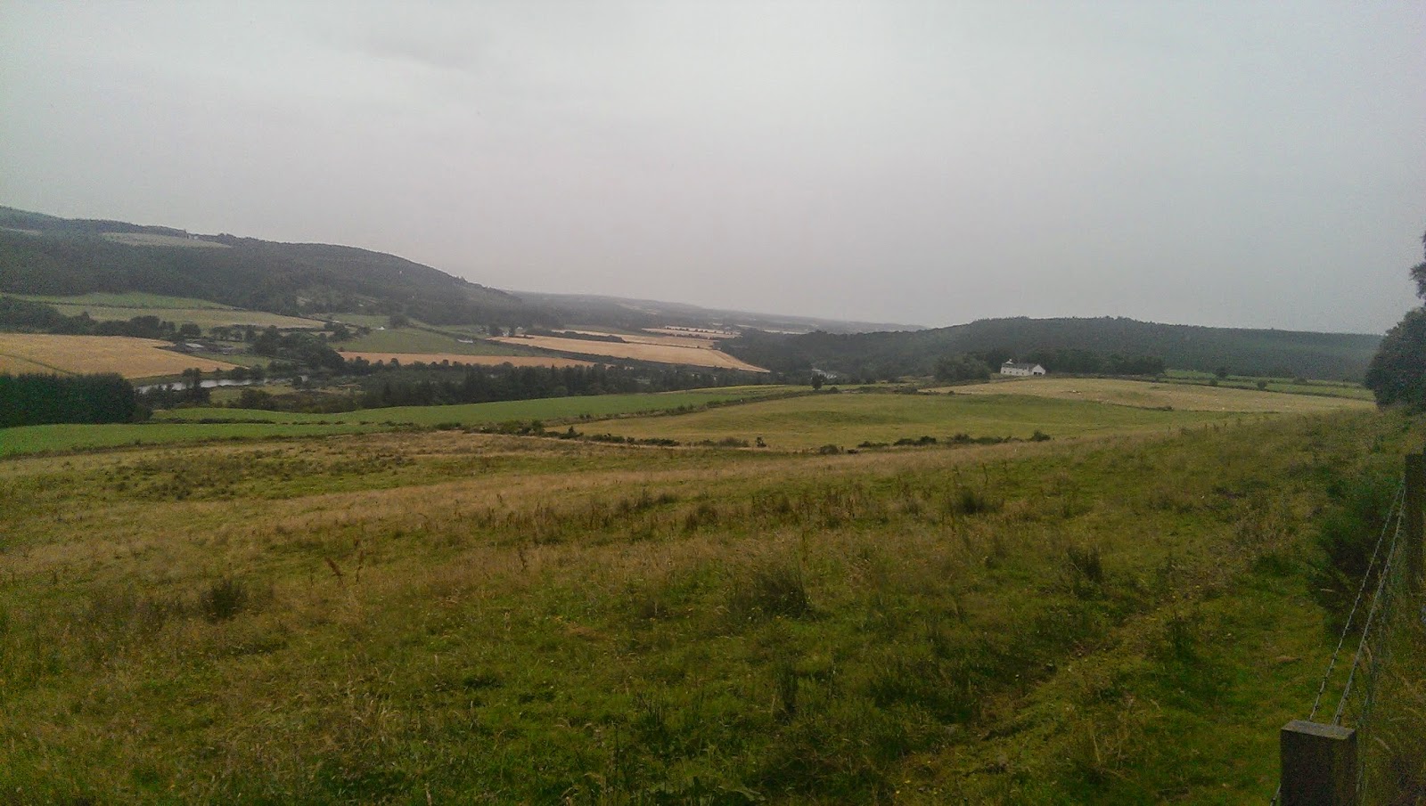
A wander along the main rd to the north end of town brought me to the start of the trail, initially it skirts some new housing estates and then meanders through some woodlands passing a golf course. After about a mile or so, you burst out into the open, the view right (south east) across to the Cairngorms is pretty stunning and on the left the track is parralled by the steam railway line which runs between Aviemore and Dulnain bridge (I think), the busy wee train passed two or three times as i was walking this stretch. The paths here are very well managed and quite decent on the feet, pretty busy (sunday traffic I suppose) with loads of folk and families out for walks and bike runs.

After a couple of hours walking on a very straight forward route I arrived in Boat of Garten, the afternoon had turned into a scorcher and the first point of call was the village shop for an ice lolly and a bottle of cold water to replace the 2 ltrs id already used, remarkably walking the length of the great river Spey, water wasnt the most forthcoming commodity. Leaving the village I followed the road down to the bridge and crossed the river, I met my first fellow spey wayer here, going the other way though, we did the customary hiker to hiker nod thing (its the law). He was fully laden like myself and asked how long it had taken me from Aviemore, he had two hours to go, I had 4 or 5 days. Two ladies also passed going my way but I didnt realise at the time they were doing the way, we were to pass each other a few times over the next two days.

The peaceful track from Boat of Garten up towards loch Garten, Scottish summer decrees that it must rain, and a rather large black cloud had been heading my way, eventually a light drizzle started and the goretex was donned.

By the time I got to Nethy Bridge it was a full on monsoon, a quick dive into the shop for a coffee and a half an hour stop sitting at the bus shelter (it was that big a cup) having a smoke (yes I know) allowed it to clear up.

There was a bunk house at the old Nethy Bridge station but I was in first day "crack on while the sun shines" mode, plus being an unsociable sod i like wild camping by myself, the nature of the way meant that good spots were rather limited and I walked a bit further than id hoped for, eventually a couple of miles short of Grantown on Spey I came across a cracking wee wooded bit, about 200m off the track and with no habitation near by.
Monday - Day 2
Tarrig Mhore to Cragganmore 18 miles


After a grand sleep, I was up, packed and away for about 0900ish on what looked like another scorcher, in no time at all I was crossing the old Spey bridge just south of Grantown, the burn was still quite high and a bit coloured, but looked like it was dropping, this afternoon or tomorrow should be the perfect storm for salmon fishing (if there's no more rain). At the bridge there were a few handy cooncil bins so I took the opportunity to get rid of yesterday's accumulated rubbish and wrappers and headed up into the village to restock on a hikers necessities (fags and wine).

The walk up to the village was really fine, through the anagach wood on a very nice soft path, the obligatory Co op provided the required supplies, and the bakers across the road supplied four fresh butteries (the food of gods and teuchters for century's) for breakfast. Leaving Grantown I cut across the golf course, a perfectly legitimate route and anyway, if they play golf like me the fairway is probably the safest place to be, but a wee look left and right before crossing would be advised just in case thon Rory loon is having a belt, mind you there was a signpost stating that skiing was only to take place on the fairways... After the golf course it was back into the anagach woods for a few miles of pleasant wanderings towards Cromdale.

Eventually you leave the woods behind as the path and river join again for a couple of hundred meters, too soon though you have to cross the burn and follow the road for half a mile or so up to Cromdale. Just after crossing I bumped into a young wifie that had been picking wild plants from the river bank, we walked together for a couple of hundred yards as she attempted to entice me into her house for tea, nothing unusual, this happens to me all the time... If I was to tell the truth though id have to admit that she had actually just opened a cracking wee tea and cake place in the old manse and was trying to get customers and the word out about it. If your passing take the time to pop in.

just before the village the way leaves the road and and cuts under a bridge and back onto the old railway just at Cromdale station. The next couple of miles are along the old railway, not my favourite walking surface but this wasn't the worst ive been on. Eventually you cross the A95 and climb in up into Tom an Uird wood, halfway up the first climb on forestry tracks I decided to have a break to get the boots and socks off, get some gehwol cream on them, a wee snack and I believe I maybe even had 15 minutes inspecting my inner eye lids. After that it was a fairly decent walk through the forest, to the Balnallan/ Dalvey area, straight away you come across the worst gating and fencing system I have ever encountered anywhere and one that will ensure I never walk the speyside way again

The gates of hell, its very very obvious that the landowner here is a rich, tory, no voing, anti walker, selfish twat. The picture above is a complete farce, that bit of fence is stuck in the middle of a field (basically a 50m x 2m pen on a path in a field) it doesn't run as far as the trees in the background, you fight your way through the ridiculous gate at the other end, walk along for about 50m then exit this gate back into the field you started in, if you know that beforehand then you just dont go through the gate at the other end and walk by this box/pen section. Theres about 4 miles of senseless palaver like this before you escape, some of the sections are so narrow that you catch gear or flesh on the wire
The fences aren't there to keep the sheep in, as the majority are only two strands with huge gaps that the sheep just walk under, the amount of sheep sleeping on the paths proved that, the wire and whole system is there for one reason only, that is to put off and quite possibly hurt walkers, it works. Some parts that you channelled into are very narrow, badly eroded and dangerous, especially if wet and slippy with some sections of barbed wire at face height.

The escape from hell, looking back over what should have been a lovely scenc walk, ive never been so happy to enter forestry, unfortunately it was short lived after the knockfrink hill/forrest it was more of the same with those bloody stupid gates. Eventually in a pretty shit mood I made it back down to the main rd, 5 minutes along the side of it on a path and I crossed over heading back down towards the river and old railway line again. Before reaching either there's a long section (300m ish) of stepping stones which might be fun for stumpy legged folk.

Back onto the old line and stride out towards Cragganmore/Ballindalloch, by this stage I was a bit knackered tbh, the miles through the "hell" section had taken it out of me, I had gained a couple of blisters in the afore mentioned section and I wasn't in the best of moods, the mood eventually started to improve now that I was moving along decent ground again.

Arriving at the wee patch set aside for camping at Cragganmore was a relief, there was already a tent there, it was the afy nice couple id spoken to at various points during the day as we had passed each other, they were in the same boat as me in regards the earlier nonsensical section, I had my supper and burst out the Maccallan for a well deserved dram or two, while we chatted and put the world to rights. The wee camp site was ideal, its free, has a very clean toilet, water on tap and bins.
Tuesday - Day 3
Cragganmore to Craigellachie 13 miles


Another cracking morning, sausage and beans from the rations, large cup of coffee, packed and away for 0830/0900. I had a belter of a blister on the seam between my sole and big toe and a smaller one on the heel so it was on with the compeed as well prior to the off. Most of today was going to be on the old railway line and alongside the river, with a few crossings thrown in.

First smoke break of the day at Blacksboat station, not to far into the day but I was still suffering a bit from the previous day, it was such a nice spot that it deserved to be utilised. There was a group of canoeists down by the river who were just breaking camp and getting back on the river to start their day afloat.

A few miles further on at Knockando is Tamdhu station, the track here runs right through the distillery, the smell is rather nice. The whole area is actually rather busy with quite a few folk walking and cycling, it also seems to be one of the main canoe launch areas as there were four or five outdoor adventure company vehicles parked up with boats in various stages of being loaded and unloaded from trailers.


Just past Carron you cross the bridge at a lovely spot, I sat on the bridge for a while having a snack and watching the salmon fishers drawing a blank.

Another wee station in the middle of nowhere, I can imagine when the trains were running they didn't really get up much in the way of speed as the stations are pretty close together.

A wee swingy bridge just at the entrance to Aberlour, once over the bridge you are in the riverside parks of the town, I headed into the centre to resupply on necessities at the usual Co op.

I hadnt really had much to eat other than a few wee snacks so I went and sat in the wee park beside the war memorial with a diet coke and a couple of butteries, it was good to get the bergan off, so I went the whole hog and removed my boots and socks as well to allow some fresh air to get in about them. I probably sat there for an hour plus, just watching the world go by. Of course the ulterior motive was that the chipper just around the corner opened at 1630, I walked past it just as the lassie turned the closed/open sign and I was in like a rat up a drainpipe, fish supper with heaps of vinegar, oh fit fine.


I left Aberlour happily digging into my supper, there was only a couple of miles to go for the day and after the long break and fine food I was feeling a lot better and really enjoying the late afternoon heat, I even stopped for a couple of minutes to chuckle at two fishermen going nuts at a couple of out of control canoeists who went straight through the pool they were fishing.

The old Craigellachie bridge, quite a poignant place for me.
Just as you enter the village you pass some large playing fields, i thought they might be the area for camping, they would have done just fine, but i decided to push into the village for a pint of guinness at the Highlander, the barman told me that there was a proper camping area just along the track a bit, The Highlander has a cracking whisky bar and it was pretty busy with a lot of folk sitting out on the veranda having meals, the pint turned into a few with a dram or two thrown in for medicinal purposes and just to prove how small a world it is, I ended up speaking to a couple of lads on a fishing holiday, one of them turned out to be the father of a lad I had joined the army with 27 years previously.
Just as you enter the village you pass some large playing fields, i thought they might be the area for camping, they would have done just fine, but i decided to push into the village for a pint of guinness at the Highlander, the barman told me that there was a proper camping area just along the track a bit, The Highlander has a cracking whisky bar and it was pretty busy with a lot of folk sitting out on the veranda having meals, the pint turned into a few with a dram or two thrown in for medicinal purposes and just to prove how small a world it is, I ended up speaking to a couple of lads on a fishing holiday, one of them turned out to be the father of a lad I had joined the army with 27 years previously.

The Craigellachie campsite and car park, the actual area set aside for tents is a good bit beyond the brown thing and trees, but when I got there there was eight or so tents already pitched and a boisterous group of kids having fun, I presumed they were part of a Duke of Edinburgh group or some such. I pitched my tent just to the right of the trees, it was ideal and a good 100m odd away from the the kids and although they were quite loud it didn't really bother me, id been in the bar for a few hours, the biggest problem I had was pitching the tent properly and once i slithered in, I was out like the proverbial light...
Wednesday - Day 4
Craigellachie to Fochabers 13 miles
Wednesday - Day 4
Craigellachie to Fochabers 13 miles

Again I was packed and ready to go for 9ish on day 4, the kids had already gone, I hadn't heard a thing from them so either they were extremely quiet or I was unconscious. The first 3 miles of todays route was on tarmac and all up hill, nightmare. I had aready decided my first break would be at killiemore where I would be turning off the road onto forestry tracks. When I got there a family were just preparing to move off after their break, I think they were using a company to move their baggage between nightly stop overs, it seemed like a good idea to me, especially after the last 3 miles. Unfortunately the climbing wasnt done for the day as the forestry track continues to climb as it skirts the lower reaches of Ben Aigan.

Eventually the track reaches its highest point and you have a wee flat ish stretch before it drops steeply, I stopped for five minutes to watch some monster machine cutting and stacking trees, there was a decent view away over the Spey valley towards speybay. It started to drizzle which was actually quite pleasant initially as it felt quite warm, I cracked on but the pleasant drizzle quickly turned into heavy rain and I stopped again to get the goretex on, for the first time on the walk squadrons of the famous Scottish midgie made an appearance which i believe is gods way of saying "get outa here bud ".
Soon after reaching the high point of the climb you turn off the forestry track onto a wee path that heads steeply down hill to a rifle range at bridgeton cottages, the red flags were flying but the route passes safely. From the range its a short wander down hill to the Boat of Brig, again you join the road for the long (mostly uphill) slog on tarmac into Fochabers, the rain was fairly dinging down now, but I enjoyed a soggy smoke down under the bridge, I had planned to have lunch but because of the rain I decided to push on for a bit, after the leaving the bridge theres a right cheeky climb up a couple of switchbacks. I was fairly puffing by the time I finally got to what I hoped was the top of the hill, so I sat under a tree on a farmers heavy roller and had a double decker and diet coke id been holding onto as a morale booster/sugar boost.

Nearly done, I was trying to catch the drips on my nose and cap, without much joy though.
The final few miles along the road into Fochabers was pretty tedious and I'd already pretty much decided that if there was a bus to Inverurie due anytime soon I was going to be on it, I'd never really seen the point of the finish being in Buckie, if you've ever been to Buckie you'll know what I mean, its also impossible to get anywhere from there, if the bus still ran to Keith (Inverness to Aberdeen train and bus stop) I might have considered it, but the council stopped that service last year much to the locals dismay. So 10 miles to Buckie then 10 miles back just wasn't part of my plan, I debated (for about 30 seconds) on just going to spey bay but again it seemed pointless as it wasnt the end of the route.
I arrived in Fochabers and a bus was due in 15 minutes, so i jumped into the final Coop of the trip for some bus journey snacks, 40 odd minutes later I arrived in Inverurie to be met by my driver for the 10 minute run home and a lovely hot bath.
Final thoughts
I really enjoyed myself, but I always do when walking, but I really really didnt like large parts of the route and wouldn't even contemplate doing it again, it wasnt remote enough, to much tarmac and the worst section of walking I think ive ever experienced between Grantown and Cragganmore
Stats
58 ish miles
3 1/2 days
1/2 Ltr Maccallan
6 pints of guinness
1 fish supper
8 butteries
2 blisters
6 double deckers
3 peperami
80 regal king size
And now id better get on and finish my tgo write up...
No comments:
Post a Comment